
Waterbury Center topographic map
Interactive map
Click on the map to display elevation.
About this map
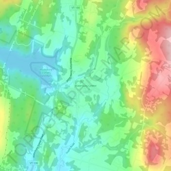
Name: Waterbury Center topographic map, elevation, terrain.
Location: Waterbury Center, Washington County, Vermont, 05677, USA (44.35811 -72.73595 44.39811 -72.69595)
Average elevation: 807 ft
Minimum elevation: 577 ft
Maximum elevation: 1,230 ft