
Katuntsi topographic map
Interactive map
Click on the map to display elevation.
About this map
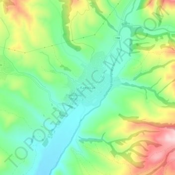
Name: Katuntsi topographic map, elevation, terrain.
Location: Katuntsi, Sandanski, Blagoevgrad, 2830, Bulgaria (41.42356 23.41084 41.46356 23.45084)
Average elevation: 745 ft
Minimum elevation: 423 ft
Maximum elevation: 1,316 ft