
Mwenezi topographic map
Interactive map
Click on the map to display elevation.
About this map
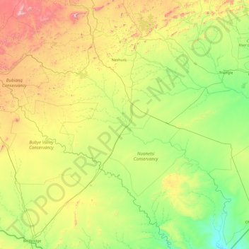
Name: Mwenezi topographic map, elevation, terrain.
Location: Mwenezi, Masvingo Province, Zimbabwe (-22.11393 29.73450 -20.68282 31.60728)
Average elevation: 1,880 ft
Minimum elevation: 696 ft
Maximum elevation: 5,190 ft
Other topographic maps
Click on a map to view its topography, its elevation and its terrain.