
Cherokee Lake topographic map
Interactive map
Click on the map to display elevation.
About this map
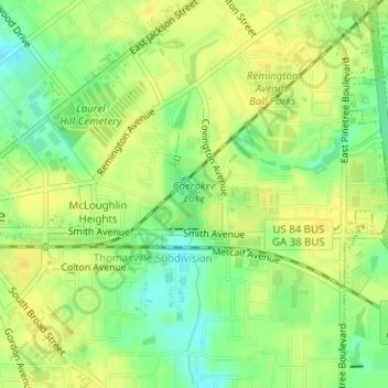
Name: Cherokee Lake topographic map, elevation, terrain.
Location: Cherokee Lake, Thomasville, Thomas County, Georgia, USA (30.83537 -83.96238 30.84077 -83.95737)
Average elevation: 282 ft
Minimum elevation: 233 ft
Maximum elevation: 308 ft