
Holyrood Park topographic map
Interactive map
Click on the map to display elevation.
About this map
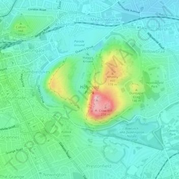
Name: Holyrood Park topographic map, elevation, terrain.
Average elevation: 220 ft
Minimum elevation: 56 ft
Maximum elevation: 784 ft
Other topographic maps
Click on a map to view its topography, its elevation and its terrain.
Carrick Knowe Community Woodland
United Kingdom > Scotland > City of Edinburgh
Carrick Knowe Community Woodland, Carrick Knowe, Corstorphine, City of Edinburgh, Scotland, United Kingdom
Average elevation: 207 ft