
Fómeque topographic map
Interactive map
Click on the map to display elevation.
About this map
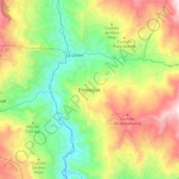
Name: Fómeque topographic map, elevation, terrain.
Location: Fómeque, Colombia (4.44717 -73.93339 4.52717 -73.85339)
Average elevation: 6,145 ft
Minimum elevation: 4,770 ft
Maximum elevation: 7,946 ft