
Penamá topographic map
Interactive map
Click on the map to display elevation.
About this map
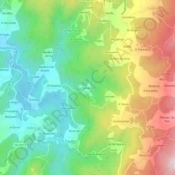
Name: Penamá topographic map, elevation, terrain.
Location: Penamá, Ourense, Galicia, 32235, Spain (42.15120 -8.13497 42.19120 -8.09497)
Average elevation: 974 ft
Minimum elevation: 246 ft
Maximum elevation: 2,103 ft