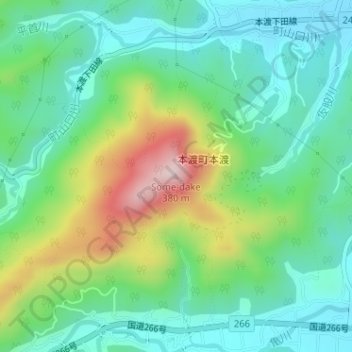
Some-dake topographic map
Interactive map
Click on the map to display elevation.
About this map
Name: Some-dake topographic map, elevation, terrain.
Average elevation: 377 ft
Minimum elevation: 26 ft
Maximum elevation: 1,201 ft

Click on the map to display elevation.
Name: Some-dake topographic map, elevation, terrain.
Average elevation: 377 ft
Minimum elevation: 26 ft
Maximum elevation: 1,201 ft