
Alt-Hoeselt topographic map
Interactive map
Click on the map to display elevation.
About this map
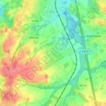
Name: Alt-Hoeselt topographic map, elevation, terrain.
Location: Alt-Hoeselt, Hoeselt, Tongeren, Limburg, 3730, Belgium (50.80776 5.47195 50.84776 5.51195)
Average elevation: 279 ft
Minimum elevation: 180 ft
Maximum elevation: 407 ft