
Chachagüí topographic map
Interactive map
Click on the map to display elevation.
About this map
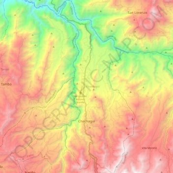
Name: Chachagüí topographic map, elevation, terrain.
Location: Chachagüí, Centro, Nariño, Pacífica, Colombia (1.29007 -77.32243 1.51953 -77.21852)
Average elevation: 6,276 ft
Minimum elevation: 2,162 ft
Maximum elevation: 10,112 ft