
First Landing State Park topographic map
Interactive map
Click on the map to display elevation.
About this map
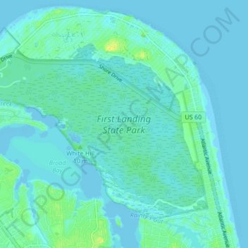
Name: First Landing State Park topographic map, elevation, terrain.
Location: First Landing State Park, Virginia Beach, Virginia, USA (36.88525 -76.05836 36.92728 -75.99051)
Average elevation: 10 ft
Minimum elevation: -7 ft
Maximum elevation: 56 ft
Other topographic maps
Click on a map to view its topography, its elevation and its terrain.
Kempsville Lake Park
USA > Virginia > Virginia Beach > Powell's Crossroads
Kempsville Lake Park, Kempsville Gardens, Kempsville, Powell's Crossroads, Virginia Beach, Virginia, USA
Average elevation: 23 ft