
Mulgund topographic map
Interactive map
Click on the map to display elevation.
About this map
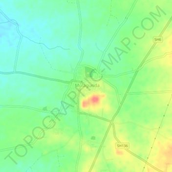
Name: Mulgund topographic map, elevation, terrain.
Location: Mulgund, Gadag taluk, Gadag district, Karnataka, 582117, India (15.26172 75.50254 15.30172 75.54254)
Average elevation: 2,215 ft
Minimum elevation: 2,139 ft
Maximum elevation: 2,333 ft
Other topographic maps
Click on a map to view its topography, its elevation and its terrain.
Gadag-Betageri
India > Karnataka > Gadag taluk
Gadag-Betageri, Gadag taluk, Gadag district, Karnataka, 582101, India
Average elevation: 2,178 ft