
Bronx River topographic map
Interactive map
Click on the map to display elevation.
About this map
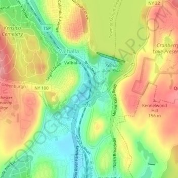
Name: Bronx River topographic map, elevation, terrain.
Average elevation: 351 ft
Minimum elevation: 180 ft
Maximum elevation: 515 ft
Other topographic maps
Click on a map to view its topography, its elevation and its terrain.
Mianus River Gorge Preserve
USA > New York > Town of North Castle
Mianus River Gorge Preserve, Town of North Castle, Westchester County, New York, USA
Average elevation: 486 ft
Eugene and Agnes Meyer Nature Preserve
USA > New York > Town of North Castle > Windmill Farm
Eugene and Agnes Meyer Nature Preserve, Windmill Farm, Town of North Castle, Westchester County, New York, 10504, USA
Average elevation: 581 ft