
Lake Seminole topographic map
Interactive map
Click on the map to display elevation.
About this map
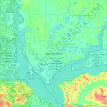
Name: Lake Seminole topographic map, elevation, terrain.
Location: Lake Seminole, Paradise Acres, Seminole County, Georgia, USA (30.70631 -84.94342 30.87315 -84.80546)
Average elevation: 105 ft
Minimum elevation: 52 ft
Maximum elevation: 302 ft