
Bechar topographic map
Interactive map
Click on the map to display elevation.
About this map
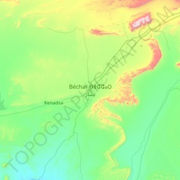
Name: Bechar topographic map, elevation, terrain.
Location: Bechar, Béchar, 08000, Algeria (31.18327 -2.40547 32.04856 -1.35362)
Average elevation: 2,657 ft
Minimum elevation: 1,886 ft
Maximum elevation: 6,391 ft