
Belknap Mountain topographic map
Interactive map
Click on the map to display elevation.
About this map
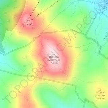
Name: Belknap Mountain topographic map, elevation, terrain.
Average elevation: 1,634 ft
Minimum elevation: 1,017 ft
Maximum elevation: 2,365 ft
Other topographic maps
Click on a map to view its topography, its elevation and its terrain.
Glendale
United States > New Hampshire > Belknap County > Gilford
Glendale, Gilford, Belknap County, New Hampshire, 03249, United States
Average elevation: 594 ft
Welch Island
United States > New Hampshire > Belknap County > Gilford
Welch Island, Gilford, Belknap County, New Hampshire, United States
Average elevation: 502 ft
Gunstock Mountain
United States > New Hampshire > Belknap County > Gilford
Gunstock Mountain, Gilford, Belknap County, New Hampshire, 03249, United States
Average elevation: 1,496 ft
Yale Estates
United States > New Hampshire > Belknap County > Gilford > Yale Estates
Yale Estates, Gilford, Belknap County, New Hampshire, United States
Average elevation: 1,280 ft