
Pulderbos topographic map
Interactive map
Click on the map to display elevation.
About this map
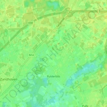
Name: Pulderbos topographic map, elevation, terrain.
Location: Pulderbos, Zandhoven, Antwerpen, Vlaanderen, 2242, België (51.20289 4.67662 51.24853 4.74263)
Average elevation: 33 ft
Minimum elevation: 3 ft
Maximum elevation: 49 ft
Other topographic maps
Click on a map to view its topography, its elevation and its terrain.