
Lara District topographic map
Interactive map
Click on the map to display elevation.
About this map
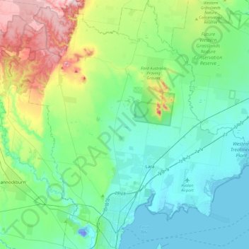
Name: Lara District topographic map, elevation, terrain.
Location: Lara District, Victoria, Australia (-38.13387 144.20252 -37.80094 144.59265)
Average elevation: 308 ft
Minimum elevation: -92 ft
Maximum elevation: 1,362 ft
Other topographic maps
Click on a map to view its topography, its elevation and its terrain.