
Steinfort topographic map
Interactive map
Click on the map to display elevation.
About this map
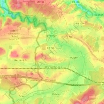
Name: Steinfort topographic map, elevation, terrain.
Location: Steinfort, Canton Capellen, Luxembourg (49.62733 5.88270 49.67618 5.95988)
Average elevation: 1,060 ft
Minimum elevation: 889 ft
Maximum elevation: 1,194 ft
Other topographic maps
Click on a map to view its topography, its elevation and its terrain.
Capellen
Luxembourg > Canton Capellen > Mamer
Capellen, Mamer, Canton Capellen, Luxembourg
Average elevation: 1,037 ft