
Reda topographic map
Interactive map
Click on the map to display elevation.
About this map
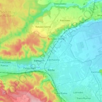
Name: Reda topographic map, elevation, terrain.
Location: Reda, Wejherowo County, Pomeranian Voivodeship, 84-240, Poland (54.58665 18.25645 54.65530 18.41237)
Average elevation: 187 ft
Minimum elevation: 0 ft
Maximum elevation: 512 ft