
Panipat topographic map
Interactive map
Click on the map to display elevation.
About this map
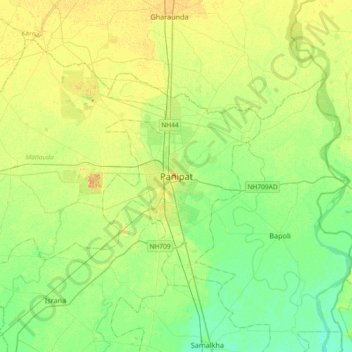
Name: Panipat topographic map, elevation, terrain.
Location: Panipat, Haryana, 132100, India (29.23128 76.81717 29.55128 77.13717)
Average elevation: 771 ft
Minimum elevation: 732 ft
Maximum elevation: 820 ft
Panipat is located at 29°23′15″N 76°58′12″E / 29.3875°N 76.9700°E / 29.3875; 76.9700.[12] It has an average elevation of 219 metres (718 feet).