
Assi Youcef topographic map
Interactive map
Click on the map to display elevation.
About this map
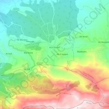
Name: Assi Youcef topographic map, elevation, terrain.
Location: Assi Youcef, Daïra Boghni, Tizi Ouzou, 15326, Algérie (36.45929 3.98759 36.54101 4.06701)
Average elevation: 3,064 ft
Minimum elevation: 968 ft
Maximum elevation: 7,031 ft