
Oberaargletscher topographic map
Interactive map
Click on the map to display elevation.
About this map
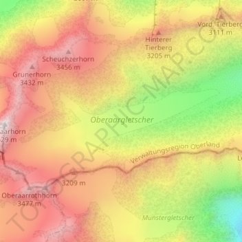
Name: Oberaargletscher topographic map, elevation, terrain.
Average elevation: 9,482 ft
Minimum elevation: 6,601 ft
Maximum elevation: 11,877 ft
Other topographic maps
Click on a map to view its topography, its elevation and its terrain.
Oberaarsee
Oberaarsee, Klettergarten Zinggen gefahrloser Zustieg querfeldein, Guttannen, Verwaltungskreis Interlaken-Oberhasli, Verwaltungsregion Oberland, Bern, 3864, Schweiz
Average elevation: 8,301 ft