
Bacalar topographic map
Interactive map
Click on the map to display elevation.
About this map
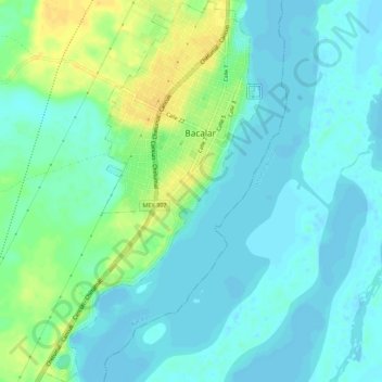
Name: Bacalar topographic map, elevation, terrain.
Location: Bacalar, Quintana Roo, Mexico (18.64413 -88.41504 18.69642 -88.38364)
Average elevation: 26 ft
Minimum elevation: -16 ft
Maximum elevation: 85 ft