
La Madrague topographic map
Interactive map
Click on the map to display elevation.
About this map
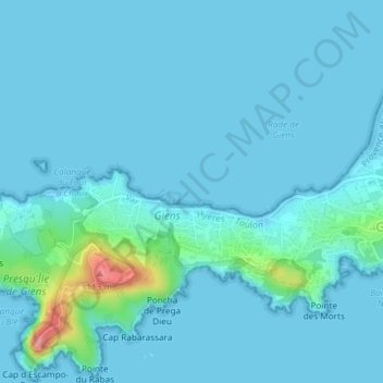
Name: La Madrague topographic map, elevation, terrain.
Location: La Madrague, La Bergerie, France métropolitaine, France (43.03070 6.10244 43.05070 6.12244)
Average elevation: 33 ft
Minimum elevation: -3 ft
Maximum elevation: 367 ft