
Ribera del Duero topographic map
Interactive map
Click on the map to display elevation.
About this map
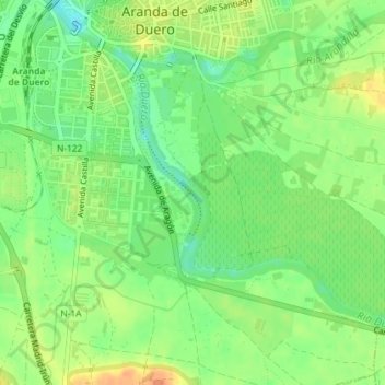
Name: Ribera del Duero topographic map, elevation, terrain.
Average elevation: 2,628 ft
Minimum elevation: 2,569 ft
Maximum elevation: 2,687 ft
Other topographic maps
Click on a map to view its topography, its elevation and its terrain.
Aranda de Duero
Spain > Castile and León > Aranda de Duero
Aranda de Duero, Ribera del Duero, Burgos, Castile and León, 09400, Spain
Average elevation: 2,776 ft