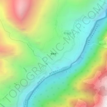
塆登郭 topographic map
Interactive map
Click on the map to display elevation.
About this map
Name: 塆登郭 topographic map, elevation, terrain.
Average elevation: 8,268 ft
Minimum elevation: 5,410 ft
Maximum elevation: 13,415 ft

Click on the map to display elevation.
Name: 塆登郭 topographic map, elevation, terrain.
Average elevation: 8,268 ft
Minimum elevation: 5,410 ft
Maximum elevation: 13,415 ft