
Indian Creek topographic map
Interactive map
Click on the map to display elevation.
About this map
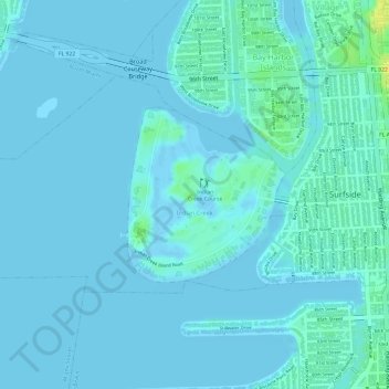
Name: Indian Creek topographic map, elevation, terrain.
Location: Indian Creek, Miami-Dade County, Florida, United States (25.87230 -80.14254 25.88446 -80.12937)
Average elevation: 13 ft
Minimum elevation: -16 ft
Maximum elevation: 82 ft