
Limerlé topographic map
Interactive map
Click on the map to display elevation.
About this map
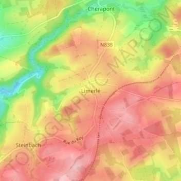
Name: Limerlé topographic map, elevation, terrain.
Location: Limerlé, Gouvy, Bastogne, Luxembourg, Wallonia, 6670, Belgium (50.13695 5.90380 50.17695 5.94380)
Average elevation: 1,552 ft
Minimum elevation: 1,289 ft
Maximum elevation: 1,729 ft