
Rangeley topographic map
Interactive map
Click on the map to display elevation.
About this map
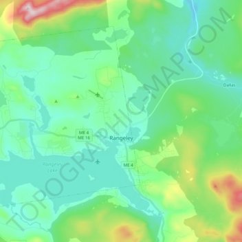
Name: Rangeley topographic map, elevation, terrain.
Location: Rangeley, Franklin County, Maine, 04970, United States (44.92186 -70.82375 45.03078 -70.62792)
Average elevation: 1,801 ft
Minimum elevation: 1,378 ft
Maximum elevation: 3,353 ft
Other topographic maps
Click on a map to view its topography, its elevation and its terrain.
Rangeley
United States > Maine > Rangeley > Rangeley
Rangeley, Franklin County, Maine, 04970, United States
Average elevation: 1,644 ft