
Sacedón topographic map
Interactive map
Click on the map to display elevation.
About this map
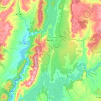
Name: Sacedón topographic map, elevation, terrain.
Location: Sacedón, Guadalajara, Castilla-La Mancha, 19120, España (40.39513 -2.78417 40.53752 -2.63307)
Average elevation: 2,595 ft
Minimum elevation: 2,090 ft
Maximum elevation: 3,481 ft