
Narvon topographic map
Interactive map
Click on the map to display elevation.
About this map
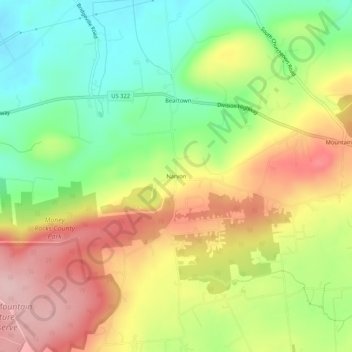
Name: Narvon topographic map, elevation, terrain.
Location: Narvon, Lancaster County, Pennsylvania, 17555, United States (40.08288 -75.99772 40.12288 -75.95772)
Average elevation: 751 ft
Minimum elevation: 436 ft
Maximum elevation: 1,109 ft