
Mongmong-Toto-Maite Municipality topographic map
Interactive map
Click on the map to display elevation.
About this map
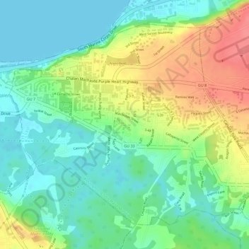
Name: Mongmong-Toto-Maite Municipality topographic map, elevation, terrain.
Location: Mongmong-Toto-Maite Municipality, Guam, United States (13.46027 144.75837 13.48206 144.78578)
Average elevation: 98 ft
Minimum elevation: 0 ft
Maximum elevation: 249 ft
Other topographic maps
Click on a map to view its topography, its elevation and its terrain.
Toto
United States > Guam > Mongmong-Toto-Maite Municipality
Toto, Mongmong-Toto-Maite Municipality, Guam, United States
Average elevation: 148 ft