
Monaghan topographic map
Interactive map
Click on the map to display elevation.
About this map
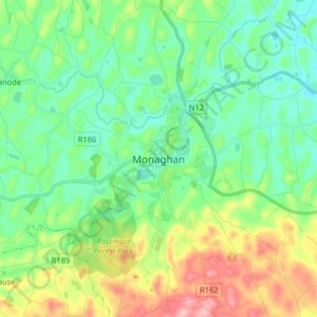
Name: Monaghan topographic map, elevation, terrain.
Location: Monaghan, County Monaghan, H18 YW81, Ireland (54.20752 -7.00927 54.28752 -6.92927)
Average elevation: 279 ft
Minimum elevation: 125 ft
Maximum elevation: 633 ft