
Tesistán topographic map
Interactive map
Click on the map to display elevation.
About this map
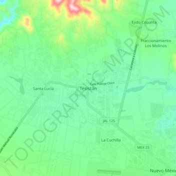
Name: Tesistán topographic map, elevation, terrain.
Location: Tesistán, Zapopan, Jalisco, 45200, Mexico (20.75892 -103.51676 20.83892 -103.43676)
Average elevation: 5,302 ft
Minimum elevation: 4,993 ft
Maximum elevation: 6,214 ft
Other topographic maps
Click on a map to view its topography, its elevation and its terrain.
CERRO LA COL
CERRO LA COL, Zapopan, Jalisco, Mexico
Average elevation: 6,115 ft