
Whalley topographic map
Interactive map
Click on the map to display elevation.
About this map
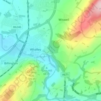
Name: Whalley topographic map, elevation, terrain.
Location: Whalley, Ribble Valley, Lancashire, England, United Kingdom (53.80241 -2.43494 53.83969 -2.37457)
Average elevation: 312 ft
Minimum elevation: 125 ft
Maximum elevation: 820 ft
Other topographic maps
Click on a map to view its topography, its elevation and its terrain.
Billington and Langho
United Kingdom > England > Lancashire > Ribble Valley > Langho
Billington and Langho, Langho, Ribble Valley, Lancashire, England, United Kingdom, Jamacia Wood
Average elevation: 328 ft