
Doil-dong topographic map
Interactive map
Click on the map to display elevation.
About this map
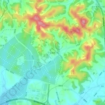
Name: Doil-dong topographic map, elevation, terrain.
Location: Doil-dong, Pyeongtaek-si, 17738, South Korea (37.03474 127.09061 37.07474 127.13061)
Average elevation: 194 ft
Minimum elevation: 52 ft
Maximum elevation: 489 ft