
Sector 1 topographic map
Interactive map
Click on the map to display elevation.
About this map
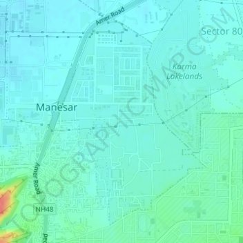
Name: Sector 1 topographic map, elevation, terrain.
Location: Sector 1, Manesar, Gurugram, Haryana, India (28.34858 76.94010 28.37166 76.95922)
Average elevation: 817 ft
Minimum elevation: 781 ft
Maximum elevation: 984 ft
Other topographic maps
Click on a map to view its topography, its elevation and its terrain.
Emerald Bay
Emerald Bay, Sector 104, Gurgaon, Gurugram, Haryana, India
Average elevation: 705 ft
Central Park
Central Park, Sector 24, Gurgaon, Gurugram, Haryana, 122010, India
Average elevation: 814 ft
Sector 107
Sector 107, Gurgaon, Gurugram, Haryana, India
Average elevation: 696 ft
Sector 101
Sector 101, Gurgaon, Gurugram, Haryana, India
Average elevation: 705 ft