
Camastra topographic map
Interactive map
Click on the map to display elevation.
About this map
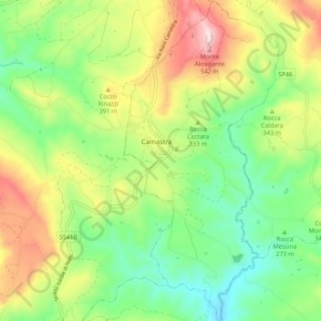
Name: Camastra topographic map, elevation, terrain.
Location: Camastra, Agrigento, Sicily, 92020, Italy (37.21266 13.78453 37.28327 13.82761)
Average elevation: 1,020 ft
Minimum elevation: 495 ft
Maximum elevation: 1,854 ft