
Stanwood topographic map
Interactive map
Click on the map to display elevation.
About this map
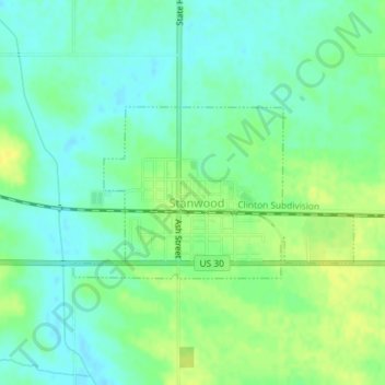
Name: Stanwood topographic map, elevation, terrain.
Location: Stanwood, Cedar County, Iowa, United States (41.88739 -91.16196 41.89944 -91.13549)
Average elevation: 837 ft
Minimum elevation: 807 ft
Maximum elevation: 873 ft
Other topographic maps
Click on a map to view its topography, its elevation and its terrain.
Lowden
United States > Iowa > Cedar County
Lowden, Cedar County, Iowa, United States
Average elevation: 745 ft
Cedar Valley
United States > Iowa > Cedar County
Cedar Valley, Cedar County, Iowa, United States
Average elevation: 751 ft
Rock Creek
United States > Iowa > Cedar County
Rock Creek, Cedar County, Iowa, 52772, United States
Average elevation: 771 ft
Clarence
United States > Iowa > Cedar County > Clarence
Clarence, Cedar County, Iowa, 52216, United States
Average elevation: 827 ft
West Branch
United States > Iowa > Cedar County
West Branch, Cedar County, Iowa, 52538, United States
Average elevation: 748 ft
Clarence
United States > Iowa > Cedar County
Clarence, Cedar County, Iowa, United States
Average elevation: 830 ft