
Oras topographic map
Interactive map
Click on the map to display elevation.
About this map
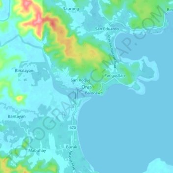
Name: Oras topographic map, elevation, terrain.
Location: Oras, Eastern Samar, Eastern Visayas, Philippines (12.10103 125.40084 12.18103 125.48084)
Average elevation: 46 ft
Minimum elevation: -10 ft
Maximum elevation: 420 ft