
Washita topographic map
Interactive map
Click on the map to display elevation.
About this map
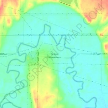
Name: Washita topographic map, elevation, terrain.
Location: Washita, Caddo County, Oklahoma, United States (35.08284 -98.36089 35.12284 -98.32089)
Average elevation: 1,253 ft
Minimum elevation: 1,201 ft
Maximum elevation: 1,368 ft