
Shah Wali Kot topographic map
Interactive map
Click on the map to display elevation.
About this map
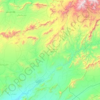
Name: Shah Wali Kot topographic map, elevation, terrain.
Location: Shah Wali Kot, Kandahar, Afghanistan (31.72709 65.66428 32.51898 66.35116)
Average elevation: 5,390 ft
Minimum elevation: 3,356 ft
Maximum elevation: 11,470 ft
Other topographic maps
Click on a map to view its topography, its elevation and its terrain.