
Des Moines topographic map
Interactive map
Click on the map to display elevation.
About this map
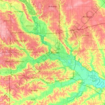
Name: Des Moines topographic map, elevation, terrain.
Location: Des Moines, Polk County, Iowa, 50319, United States (41.43103 -93.76467 41.75103 -93.44467)
Average elevation: 889 ft
Minimum elevation: 738 ft
Maximum elevation: 1,024 ft
Other topographic maps
Click on a map to view its topography, its elevation and its terrain.
Scott Avenue Dam
United States > Iowa > Polk County > Des Moines
Scott Avenue Dam, Des Moines, Polk County, Iowa, 50319, United States
Average elevation: 810 ft