
Jerimoth Hill topographic map
Interactive map
Click on the map to display elevation.
About this map
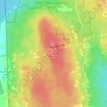
Name: Jerimoth Hill topographic map, elevation, terrain.
Average elevation: 709 ft
Minimum elevation: 577 ft
Maximum elevation: 810 ft
The hill is located on Route 101 in Foster, a half mile from the Connecticut line. To ascend the summit, for which there is a sign, there is a .3-mile (480 m) long trail that has a mere 10-foot (3.0 m) elevation gain. The hill is 812 feet (247 m) high and is located 15 miles (24 km) west of Providence, Rhode Island, and 35 miles (56 km) east of Willimantic, Connecticut.