
Kolea topographic map
Interactive map
Click on the map to display elevation.
About this map
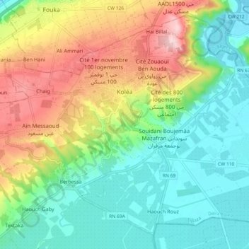
Name: Kolea topographic map, elevation, terrain.
Location: Kolea, Kolea District, Tipaza, Algeria (36.59507 2.74120 36.66001 2.83284)
Average elevation: 266 ft
Minimum elevation: 13 ft
Maximum elevation: 725 ft