
Carlentini topographic map
Interactive map
Click on the map to display elevation.
About this map
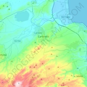
Name: Carlentini topographic map, elevation, terrain.
Location: Carlentini, Siracusa, Sicily, 96013, Italy (37.15217 14.91131 37.36498 15.09312)
Average elevation: 617 ft
Minimum elevation: -7 ft
Maximum elevation: 2,835 ft