
Campeche topographic map
Interactive map
Click on the map to display elevation.
About this map
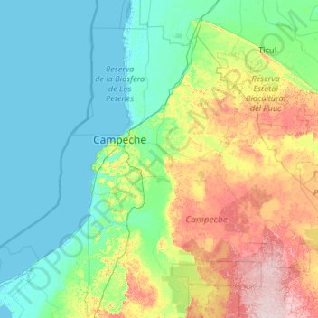
Name: Campeche topographic map, elevation, terrain.
Location: Campeche, Mexico (19.22094 -91.97896 20.20862 -89.86114)
Average elevation: 180 ft
Minimum elevation: -10 ft
Maximum elevation: 968 ft
Other topographic maps
Click on a map to view its topography, its elevation and its terrain.