
Nanmangalam topographic map
Interactive map
Click on the map to display elevation.
About this map
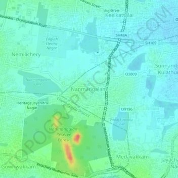
Name: Nanmangalam topographic map, elevation, terrain.
Location: Nanmangalam, Thiruvallur district, Tamil Nadu, 600117, India (12.91822 80.15825 12.95822 80.19825)
Average elevation: 43 ft
Minimum elevation: 10 ft
Maximum elevation: 167 ft