
Kandahar topographic map
Interactive map
Click on the map to display elevation.
About this map
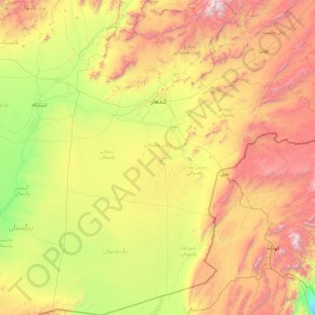
Name: Kandahar topographic map, elevation, terrain.
Location: Kandahar, Afghanistan (29.52943 64.50248 32.58691 67.79608)
Average elevation: 4,449 ft
Minimum elevation: 1,184 ft
Maximum elevation: 12,041 ft
Other topographic maps
Click on a map to view its topography, its elevation and its terrain.